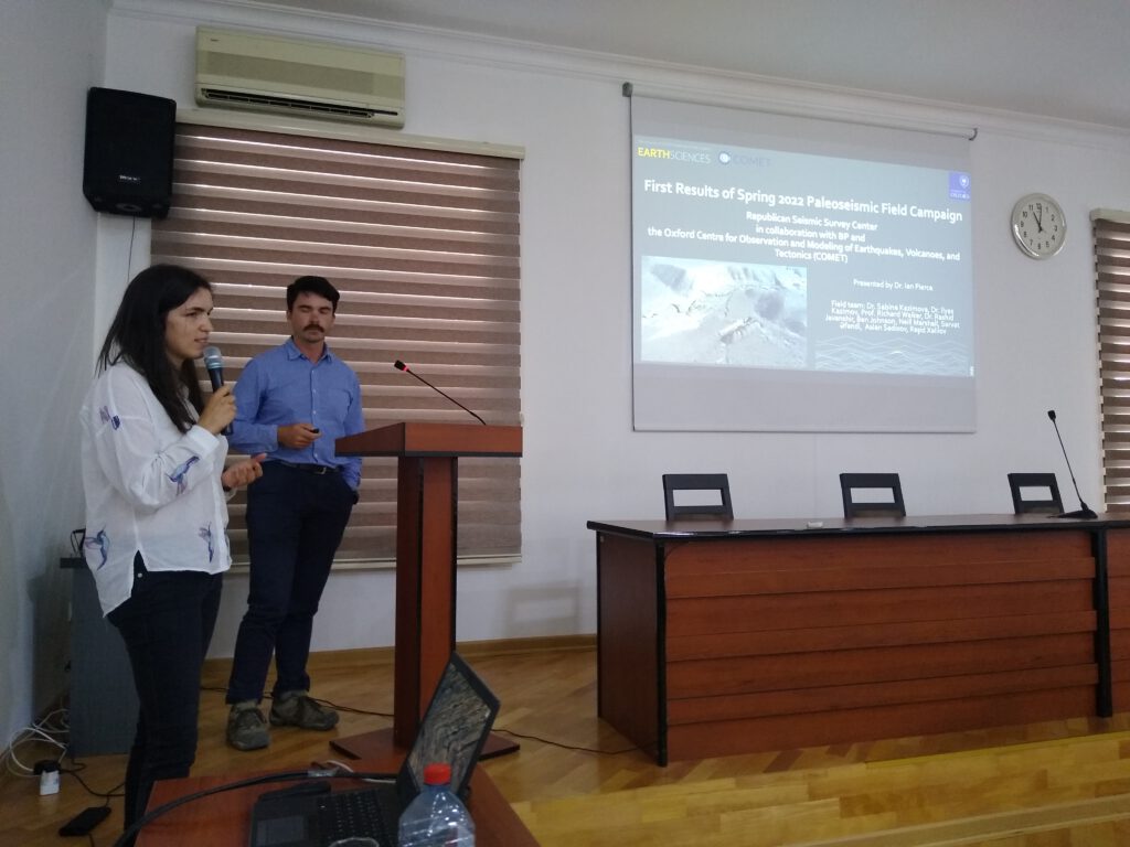
In this blog post, Ian Pierce, describes work that he is leading in collaboration with the Azerbaijan National Academy of Sciences as part of the Leverhulme Trust EROICA and NEPTUNE projects.
In April and May of 2022, the Quakes in Central Asia team traveled to Azerbaijan to conduct paleoseismic studies of the major faults that control the fascinating tectonic region covering the western Caspian and Greater Caucasus. Neill Marshall, Ben Johnson, and Ian Pierce under the direction of Prof. Richard Walker from Oxford joined with Sabina Kazimova and Ilyas Kazimov of the Republican Seismic Survey Center of Azerbaijan under the facilitation of General Director Gurban Yetirmishli.
Azerbaijan is one of the most amazing places on the planet to study earthquakes and tectonics. Here, a triple junction is formed between the Absheron Sill, West Caspian Fault zone, and the Greater Caucasus Frontal Thrusts in the Kura Basin. In Azerbaijan, the Iranian plate is crushing northward into Eurasia at a rate of about a centimeter per year. From the Black Sea to Central Azerbaijan, this motion is accommodated by the east-striking thrust faults that have built the 5-km-high Greater Caucasus Mountains.Yet mysteriously, the Caucasus disappear along their strike into the Caspian Sea- near Baku. To the east across the sea in Turkmenistan, is the Kopet Dagh fault (KDF), a major northwest-striking right-lateral strike slip fault with a 1 cm/year slip rate. The KDF projects across the sea into the Caucasus. This thrust-strike slip transition that occurs somewhere along the Absheron Sill in the Caspian Sea doesn’t seem to make kinematic sense as a structure that would form the basin that holds the sea. So what is happening? How does this triple junction work? Where is the motion transferred?
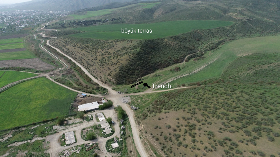
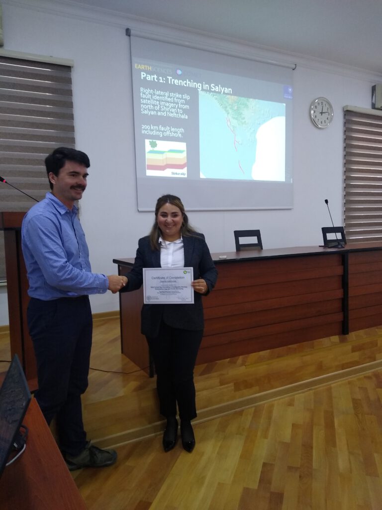
WIth this aim, as well as to better understand the seismic hazards of the region, we excavated trenches across two of the main faults that make up this triple junction: a strike-slip fault in the Kura Basin, and one of the Kura thrust faults that is the easternmost part of the Greater Caucasus Thrust.
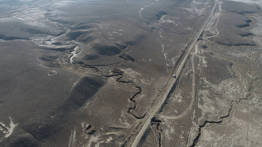
Our satellite-based fault mapping reveals a series of very active strike-slip faults in the northeastern part of the Kura Basin (the foreland of the Caucasus), to the south of Baku. Yet basically nothing is known of these faults, and modern seismicity is relatively quiet along them.
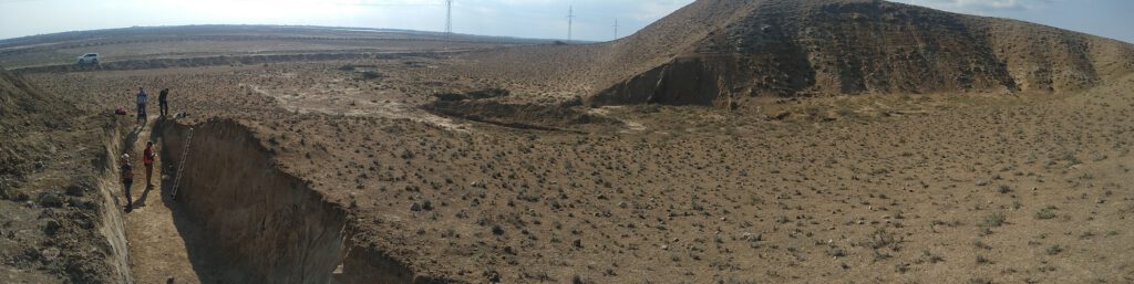
We excavated two trenches at the above site where a prominent strike-slip fault cuts through young marine sediments and wave-cut platforms. The first trench revealed a sequence of fluvial sands and aeolian silts stacked against highly sheared clays and sands. Within the young sediments was a nearly vertical flower structure.
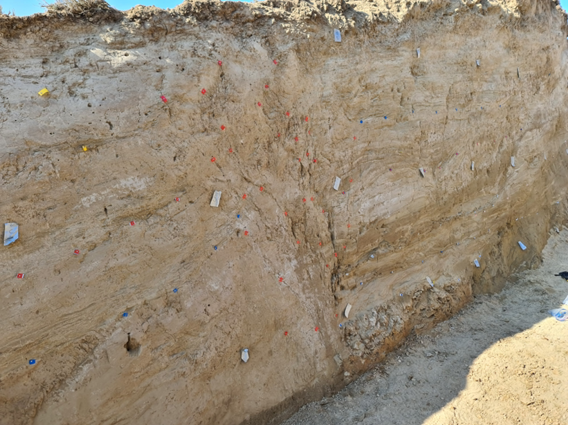
Based on different levels of upward terminating fault strands, capped zones of sheared sediments, and buried fissures, we documented 6 paleo-earthquakes. It will take some time to analyze the ages of the sediments to determine the precise earthquake timing, but we expect that these are all Holocene aged ruptures (<10k yr).
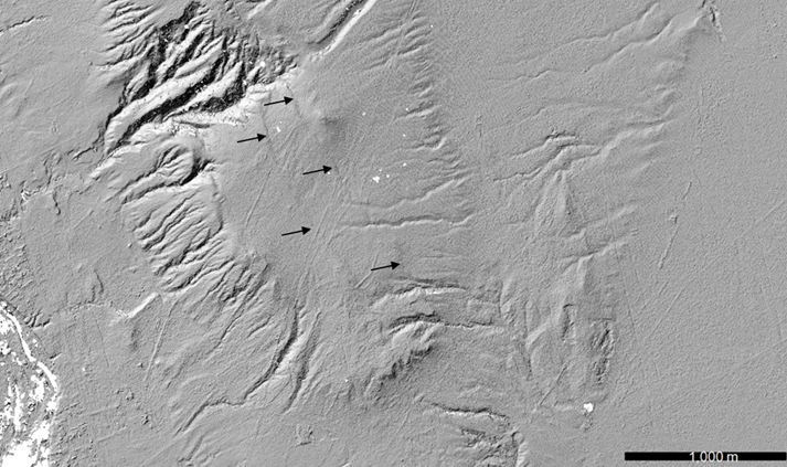
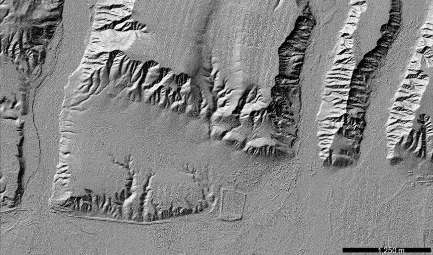
The next fault we focused our work on was the Greater Caucasus Thrusts in the Kura basin. From GPS geodetic observations, we know that the Kura fault system accommodates nearly a cm/yr of compression. It has produced many historical earthquakes, including devastating events in 1667 and 1902 that destroyed the city of Shemakhi. This fault has built an impressive set of folds and water gaps as shown in the below satellite image. Yet surprisingly little is known of these faults’ earthquake potential.
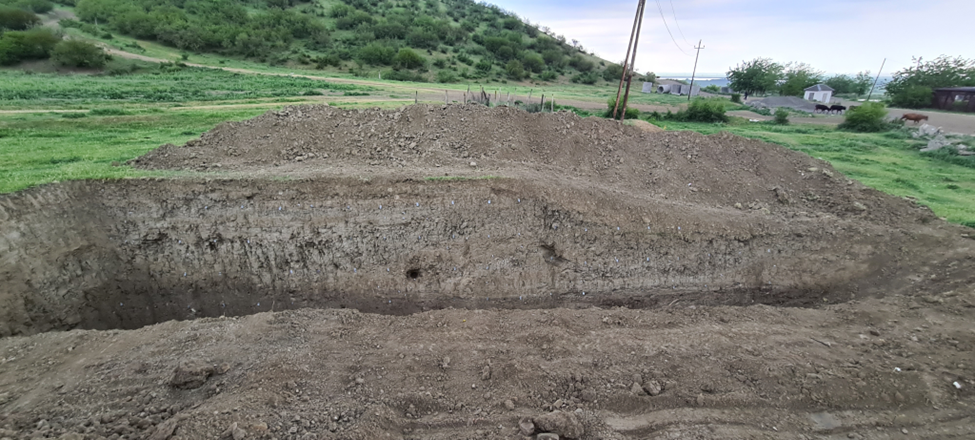
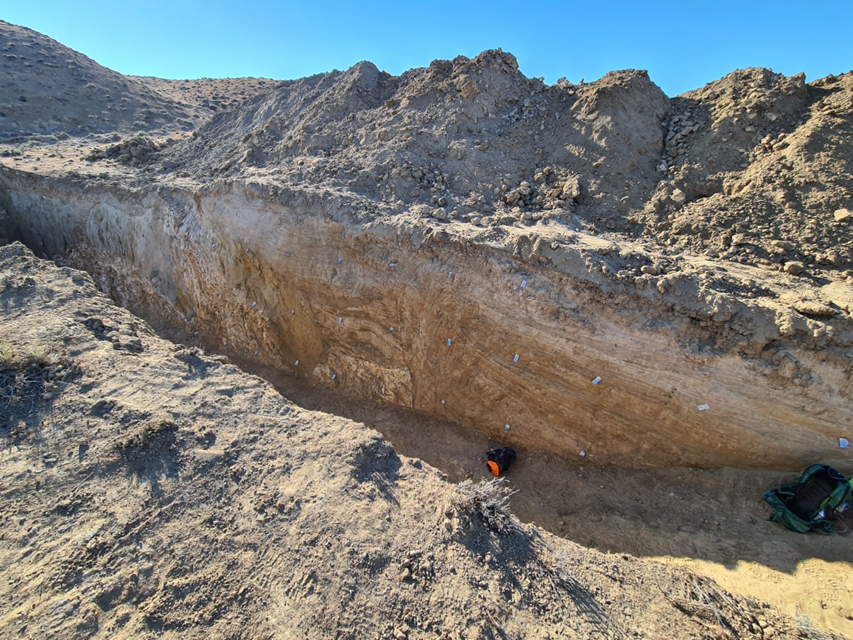
Our trench revealed a low angle fault that has displaced sedimentary layers approximately 7 m. Initial radiocarbon results shows that this rupture occurred in the late-18th to early-19th century, coinciding with the 1902 Shemakhi earthquake. This is the first trench to reveal the source fault of this pre-instrumental earthquake. It is truly amazing we got this lucky with our first go at trenching in Azerbaijan!
The final part of this field campaign consisted of a dense seismometer deployment. But I will leave that for another blog post.
We finished our visit with a field tour joined by Richard Walker and Rashid Javanshir before attending meetings to discuss the status of the project and future plans at the RSSC in Baku.
We had a really fantastic time with our amazing colleagues from the Republican Seismic Survey Center, and we are truly grateful for the opportunity they have granted us to work together on what will likely be a long, and already fruitful collaboration. Azerbaijan has some truly world-class geology, and the combination of different tectonic structures with high rates of geomorphic processes makes for a great natural laboratory. We’re excited at the prospect of our next visit.
2 replies on “A month in Azerbaijan: promising new start to a long paleoseismic campaign”
Respected sir
I am also working in the field of Paleoseismology in NE part of India. Recently we heve been to the field and observe the evidences left by past earthquake and collected Samples for dating and other analysis.
Sir I am interested in doing fieldwork with you to learn techniques and more importantly in the field evidences how to observe in a trench.
Thanking you sir.
Regards
Mujahed
Dear Mujahed. Many thanks for your interest, and I hope we will get the chance to exchange ideas in future. I am keen to develop workshops where a wide array of specialists can exchange methods and results in palaeoseismology and earthquake geology.